OCCIDENTAL/BRUNSWICK LODE
Tonogold’s drills recently hit 25 m of 13.49 g/t Au and 38.4 g/t Ag near-surface on the Occidental/Brunswick Lode. See Tonogold’s February 2, 2021 Press Release for more information.
The Occidental/Brunswick Lode is an epithermal vein structure mineralized with gold and silver about 1.5 km east of the main Comstock Lode and parallel to it, which also dips east at approximately 45 degrees.
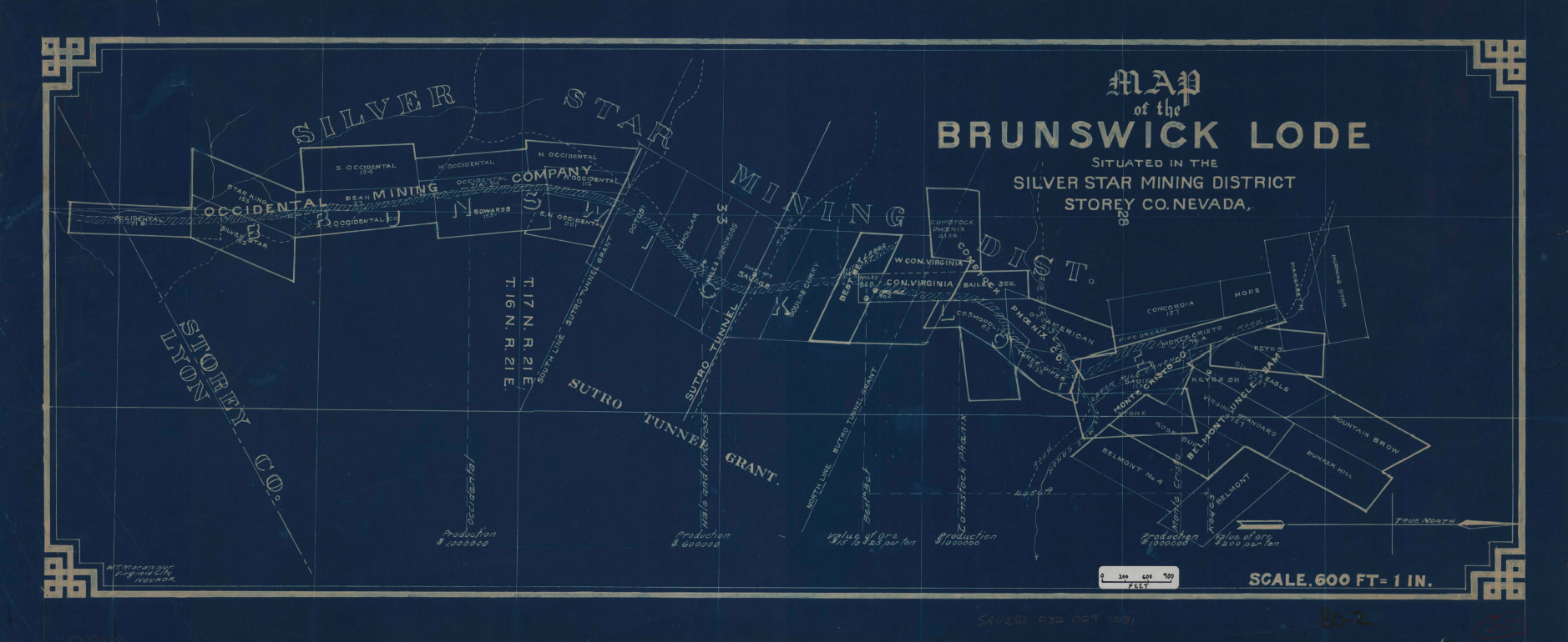
The Occidental/Brunswick Lode has a mapped strike length of approximately 4.5 kilometers. Tonogold controls about 600 meters of that strike and is currently negotiating revised lease terms for an additional 3.3 kilometers of the Occidental/Brunswick lode, which if executed, will allow the Company to continue exploration of these areas.

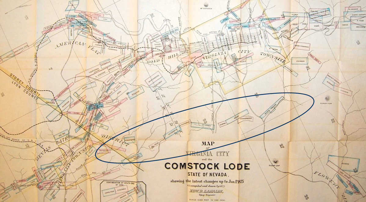
Circled on this 1875 map are the claims along the strike of the Occidental/Brunswick Lode, parallel to the Comstock Lode claims in the top center.
Geologists estimate the mineralization of the Occidental/Brunswick Lode occurred approximately 13.4 million years ago.
In that era, the Occidental Mine was by far the most active company on the Occidental/Brunswick Lode. The Occidental Mine was the only claim along the strike of the lode blessed by a hillside surface topography that allowed it to be worked via adits. The adits relieved the Occidental Mine of hoisting and pumping costs and lowered its handling costs. The mine built a mill near the entrance to its lower adit, which eliminated the cost of transporting ore to a remote mill site. Consequently, the Occidental Mine benefited from much lower costs than the other mines on the lode.
The other claims on the lode—the Monte Cristo, Cosmopolitan, Bailey, Alabama, and the St. Johns—produced decent sums from their near-surface workings in the early 1860s, but after unsuccessfully battling with underground floods around their 150-foot levels, most don’t seem to have done much besides the annual amount of work required to hold the claims.
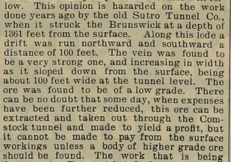
In the late 1870s, the 4-mile long Sutro Tunnel, dug from the Carson River Valley to the Comstock Lode in the 1870s, intersected the Occidental/Brunswick Lode at a vertical depth of 1,361 feet (about 1,900 feet from the surface croppings on the eastward dip of the lode). The Occidental/Brunswick Lode was about 100 feet wide at the intersection and mineralized throughout, although not of sufficiently high grade to justify extraction and processing.

This excerpt from the December 12, 1896 issue of the Mining & Scientific Press describes the intersection of the Occidental/Brunswick Lode and the Sutro Tunnel.
“There can be no doubt that some day, when expenses have been further reduced, this ore can be extracted… and made to yield a profit” is a near perfect encapsulation of the Tonogold project written more than 120 years ago.
Each mine bought the same amount of ground on the Occidental/Brunswick Lode that they held on the Comstock Lode. That meant 1,300 feet for the Con. California & Virginia, 612.5 feet for the Gould & Curry, 526 feet for the Best & Belcher, 612 feet for the Savage, 400 feet for the Hale & Norcross, 700 feet for the Chollar, and 700 feet for the Potosi.
Describing the venture, the Territorial Enterprise (quoted in the Mining & Scientific Press on June 1, 1895) considered it
(Promotional articles in the Enterprise in this era should be taken with a grain of salt—like the mines, the newspaper was fighting for survival.)
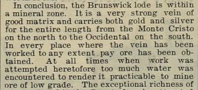
The involved mines commissioned a report on the venture. The Mining & Scientific Press published excerpts on June 15, 1895. The reported wrapped up as follows:

Through the rest of 1895, 1896, and 1897, the mines prospected the 200-, 300-, 400-, 500-, and 600- foot levels of the Occidental/Brunswick Lode. On every level, they found large quantities of mineralized rock. They extracted and processed ore that sometimes paid well enough to cover monthly operating expenses, but the mines never did find an ore body of sufficient size and concentration to tip them back into profitability.
TONOGOLD IN A STRATEGIC POSITION ON THE LODE
As related in Tonogold’s February 2, 2021 Press Release, Tonogold secured an option on a group of claims covering the southern extensions of the Occidental/Brunswick Lode.
The owner of those claims had conducted a small-scale reverse circulation (RC) drill program in 2018. That program demonstrated the presence of significant near-surface oxide gold and silver mineralization. Consequently, Tonogold developed an exploration program to confirm and expand on those results. The first phase of Tongold’s Occidental/Brunswick exploration encompasses 22 holes with an initial budget of approximately $600,000. The first two holes of this program were completed in December 2020.
The first of those holes confirmed known high-grade mineralization by drilling within 2 meters of a hole drilled in the 2018 program. The hole returned 25 m of 13.49 g/t Au and 38.4 g/t Ag between the down-hole depths of 7.92 meters and 32.92 meters.
To start the second hole, Tonogold stepped 23 meters to the northwest and completed a second hole. Preliminary results indicate that the second hole intersected the near-surface mineralized zone encountered in the first. Final assay results for the second hole are pending.
For full details of both holes and of Tongold’s Occidental Brunswick exploration program, see Tonogold’s February 2, 2021 Press Release.
Should results of Tonogold’s initial exploration of the Occidental/Brunswick Lode warrant, Tonogold plans to expand exploration of the structure with an eye toward defining economical gold and silver resources.
Tonogold believes that significant quantities of economical gold and silver remains in the Occidental/Brunswick Lode.


